
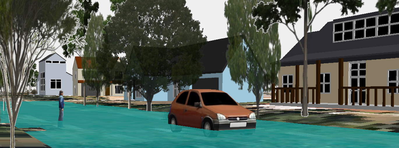
(Visualisation of a current climate 100 year flood event in southeast Queensland)
The Australian Climate Change Adaptation Research Network for Settlements and Infrastructure (ACCARNSI) Forum and Workshop was held 15 – 17, February 2016 on the Campus of the University of Canberra, ACT. ACCARNSI is one of four National Climate Change Adaptation Research Facility (NCCARF) hosted adaptation research networks. The goal of the event was to provide an opportunity for researchers and practitioners in engineering, urban planning, built environment, and social sciences to meet and share their work and observations on climate change adaptation research in Australia. Workshop participants included early career researchers and practitioners from Queensland, New South Wales, the Australian Capital Territory, South Australia and Tasmania as well as academics with long standing NCCARF connections from the University of Canberra, the University of New South Wales and Griffith University.
City Futures Research Centre’s focus on city shaping, housing, change, well-being and analytics can potentially add value to the settlements and infrastructure focus of ACCARNSI. Topics of the early career researcher and practitioner presentations included community understandings of place, integrated land-use and transportation modelling, climate migration, sustainable development, climate impacts on agriculture, building facades and outdoor microclimates, urban vegetation, the performance of urban green infrastructure, financing models for coastal protection, climate impacts on stormwater infrastructure, tourism and local government’s role in climate change adaptation.
My goal for the workshop was to present research on the use of geographic visualization as a tool for information exchange about climate impacts. The specific aim of this research is to test methods and evaluate the effectiveness of geographic information-based tools to communicate information. Initial results show that the multiple visual methods tested for communicating climate information were effective, but 3D visualization was the most effective method for knowledge exchange. The research speaks to the use of spatial decision support systems and spatial planning more broadly to be able to help coastal communities confront the combined effects of climate change: flooding, sea level rise, storm surge, and severe weather events. Preliminary publications emerging from this research are available from the Australian Journal of Maritime & Ocean Affairs and in the edited volume Planning Support Systems and Smart Cities.
Themes that emerged over the three days of presentations and discussions include the roles of different levels of government and cross-boundary governance issues in climate adaptation. Numerous presentations touched upon the use of Intergovernmental Panel on Climate Change (IPCC) scenarios and time horizons on perceptions of threat. It was consistently found that long time frames diminish perceptions of threat. From a local government perspective, it was agreed what’s needed are projected climate data linked to specific near term time frames.
Workshop overviews are also available from the University of Canberra Institute for Governance and Policy Analysis as well as University of Canberra Media & Communications.
No Comments so far ↓
There are no comments yet...Kick things off by filling out the form below.