By Carmela Ticzon, City Futures Research Centre.
Sustainable Urban Development (SUD) recognises that places and spaces are complex and multilayered. Cities are systems composed of interlinking environmental, social, and economic dimensions, and the interdependencies of their subsystems make it impossible to make changes in one without causing flow-on effects on the others.
It makes sense, then, for agencies tasked with delivering urban infrastructure to work together and coordinate their activities—to collaborate. However, in practice collaboration all too often appears elusive, even chimerical. Significant institutional and technical barriers undercut the effectiveness of collaborative efforts:
- Institutional lock-in – Incompatibility in the way institutions do business may be a significant roadblock to inter-agency collaboration, especially in cases where agencies have had a historic tendency to work in silos. The conventions of how an institution operates, including legislative mandates, formal contracts and procurement processes, organisational culture and protocols develop over time (Foxon 2002). While these conventions are in place to help the institution optimise its own operation, their inertia can hamper an agency’s ability to adapt when collaborative processes call for flexibility and change.
- Language barrier – Similar to institutional conventions, specialised technical terms and semantics are often employed to help professionals within the same discipline or agency communicate efficiently. But these can hinder effective communication when the experts from different disciplines come together to discuss a common issue.
- Uncertainty – the flow-on effects of infrastructure interventions to an urban system are impossible to fully predict. Cities continuously evolve in complexity, and so there will always be geographical data and knowledge that are unknown to planners and decision-makers.
In parallel, agencies also operate in incomplete information with regards to the preferences and values of other stakeholders. These uncertainties make collaborative efforts politically uncomfortable, particularly if the outcomes cannot be easily predicted nor guaranteed.
While Geodesign is not a catchall solution to these challenges, undertaking the process can help agencies and stakeholders unpack the complexities of their planning context and map out resolutions. But what is Geodesign and how does it work?
What is Geodesign?
Geodesign is a thought process for strategic planning that is driven by stakeholder interaction. In a Geodesign exercise, participants share their own knowledge of the study area, acknowledge different stakeholder values and interests, and take into account available geo-information to inform their assessment of the study area’s current state and options for future interventions.
Carl Steinitz, who pioneered Geodesign with his colleagues at Harvard Graduate School of Design, uses this diagram in his book A Framework for Geodesign to summarise the reiteration of participants’ thought process through six guiding questions that contextualise the study area.
How does it work?
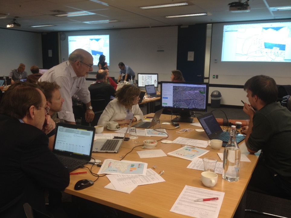
Geodesign exercises are typically executed through intensive two-day workshops. Participants are driven to negotiate with each other with the instruction to reach a consensus design for the study area by the end of the workshop.
Geographic data and participant knowledge that would contextualise the current state and issues of the study area communicated through simple maps and diagrams. These maps and diagrams serve as a ‘common language’ for the participants to operate in during the exercise. A GIS application is used to capture the maps and diagrams drawn by the participants, and record subsequent versions produced as the workshop progresses.
Participants negotiating designs with mapping tools at first Geodesign Workshop in Sydney organised by CFRC.
So what?
Whether or not participants are successful in reaching a consensus design for the study area’s future, going through the Geodesign process will identify where there is conflict or commonality of interest within the study area. These discussions may serve as a basis for reasoning out the viability of some intervention options over others. By negotiating with each other, each participant will ideally gain deeper insight into the political, social, environmental, financial, and temporal considerations that are tied to proposed intervention projects.
Furthermore, the process can help identify where there are gaps in knowledge about the study area—what geographical data and technologies could be called into service to better inform future planning. And finally, the exercise presents participants with an opportunity to substantiate the need for inter-agency cooperation going forward.
The utility of Geodesign can be seen in the structure it lends to facilitating stakeholder negotiations during strategic planning. However, the value of Geodesign is in its capacity to uncover the specifics behind the barriers to inter-agency collaboration, yield outlines for potential resolutions, and hopefully lay a foundation for effective collaborative planning.
Click here to learn more about the first Geodesign workshop in Sydney and other projects at City Futures Research Centre.


No Comments so far ↓
There are no comments yet...Kick things off by filling out the form below.